Intelligent Virtual Territories

Create dynamic digital replicas of your territories for optimized urban planning and territorial management

Our geospatial intelligence and digital twin expertise revolutionizes territorial planning by combining georeferenced 3D modeling, high-precision LiDAR analysis, and real-time IoT integration. With UrbanMirror, our proprietary Digital Twin platform, we transform urban complexity into actionable intelligence.

expertise
Product Description

UrbanMirror Digital Twin Platform and advanced geospatial solutions for intelligent territories

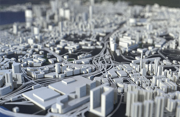
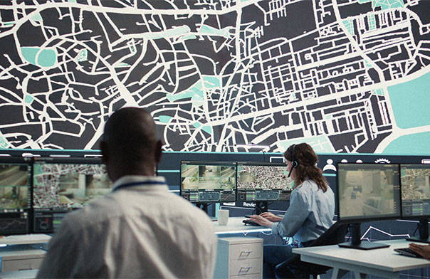
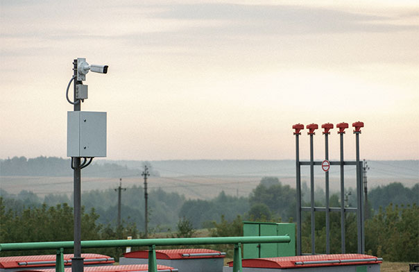
Our UrbanMirror platform revolutionizes infrastructure planning and management by creating a dynamic, interactive, and intelligent virtual replica of your territory. This solution integrates precise 3D modeling based on high-definition LiDAR analysis, real-time IoT data, and advanced simulations for infrastructure and public services optimization, transforming scattered territorial data into unified global vision for informed strategic decision-making.

Features & Benefits

Key Features

UrbanMirror - Proprietary Urban Digital Twin

Complete Digital Twin platform creating dynamic virtual replica with georeferenced 3D modeling, real-time IoT integration, and advanced simulations for optimized territorial planning.

Mastered LiDAR to GIS Process

Expert conversion of LiDAR data into exploitable multi-layer GIS with automatic thematic classification (signs, sidewalks, vegetation) and standard format export (Shapefile, GeoJSON, GPKG).

GIS Based Addressing & Local Geocoding

Centralized georeferenced addressing system with complete address registry, precise spatial coordinates, and customized local geocoder for municipal services integration.

Taxable Assets Inventory and Management

Automated solution combining mobile mapping, drone cartography, and AI classification for exhaustive territorial assets inventory and tax revenue optimization.

Unified Geographic Information Systems

Unified spatial database for territorial applications with exceptional cartographic precision and seamless multi-source geographic data integration.

KEY INDUSTRIES

Key Industries We Support

Smart Cities & Public Services

Urban digital twin and territorial planning UrbanMirror Digital Twin Platform, unified GIS systems, and georeferenced addressing solutions for public administrations, territorial communities, and urban infrastructure managers. Specific solutions: UrbanMirror Digital Twin, GIS-Based Addressing, automated tax inventory, IoT environmental monitoring, 3D urban planning

Industry, Manufacturing & Energy

Industrial geospatial intelligence and asset management Industrial facility mapping, critical infrastructure digital twin, and GIS systems for logistics optimization and predictive maintenance of industrial assets. Specific solutions: Industrial facility Digital Twin, infrastructure LiDAR mapping, industrial GIS, geospatial asset tracking

Supply Chain, Logistics & Transport

Advanced geolocation and territorial optimization High-precision geospatial tracking solutions, territorial data-based route optimization, and logistics network digital twin for intelligent supply chain. Specific solutions: 99.9% precision geolocation, geospatial route optimization, logistics network Digital Twin, territorial flow mapping

Education & Knowledge

Educational geomatics and territorial research Educational GIS platforms, territorial modeling tools for academic research, and specialized training in geomatics and territorial intelligence. Specific solutions: Educational GIS platforms, geospatial research tools, geomatics training, academic territorial projects

Specializations &
Key Solutions

Geospatial Intelligence

Urban Digital Twin

Digital Twin

LiDAR

GIS

Geolocation

Urban Planning

UrbanMirror

Mapping

Territorial Intelligence

Ready to Develop
Your Custom
Solution?

Our team of software engineering experts is available to transform your ideas into high-performance, scalable applications.